
Lunar Cave
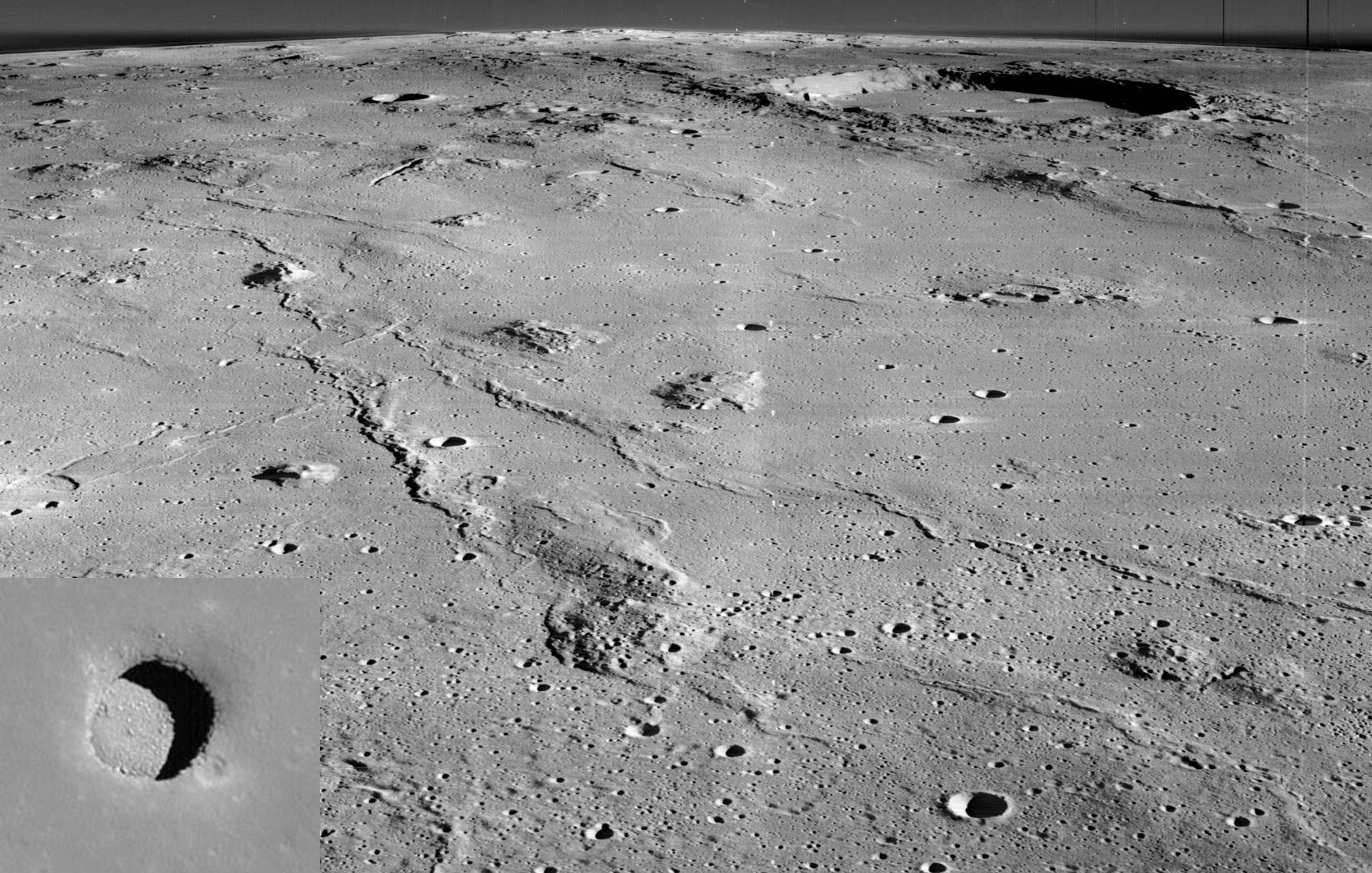
LRO radar image of "hole in the Moon" in the region of Marius Hills. (Image credit: NASA and Lunar Orbiter 2. Inset: LRO)
In 2009, Japan's SELENE spacecraft imaged a curious hole in the Lunar surface. Some follow-ups from the Lunar Reconnaissance Orbiter (LRO) were able to determine that the hole was some 100 meters deep and several hundred meters wide.
Recently, a re-analysis of radar data from SELENE was able to show an unusual secondary echo pattern coming from the region. These findings indicate a series of underground lava tubes, formed during the Moon's active volcanic period billions of years ago, which extend downward for several kilometers and stretch out perhaps 100 kilometers.
The buzz around this discovery is the possibility of using these caves to house potential Moon colonies -- or even future cities.
Though, of course, these developments are far into the future, I can't pretend I'm not excited at the prospect of my own little Moon-Cave.


This article presents an intriguing example of how radar data can be used to investigate the Moon's surface and possible underground structures. The re-analysis of SELENE radar observations identified an unusual secondary echo pattern, with the findings suggesting underground lava tubes extending beneath the lunar surface. The possibility of using such structures for future lunar habitats adds an interesting practical dimension to the research.
ReplyDeleteThe use of radar imagery and analysis of lunar surface information is closely related to image-based research, making Ieee Image Processing Project Titles relevant for exploring similar technical applications involving image and signal data.
The article also demonstrates how previously collected scientific data can be re-analyzed to obtain additional information about physical structures. This type of computational analysis can be relevant to Data Science Projects For Final Year, particularly for projects involving large datasets and extracting meaningful patterns from observational data.
ReplyDeleteAnother interesting aspect is the use of radar observations to investigate structures that cannot be directly observed from the surface. Working with such computational techniques can benefit from programming knowledge, including the skills developed through Python Online Course, for processing and analyzing scientific datasets.Python Online Training
ReplyDelete